Oooops!
{multithumb full_width=100% full_height=100% caption_pos=below caption_type=alt}
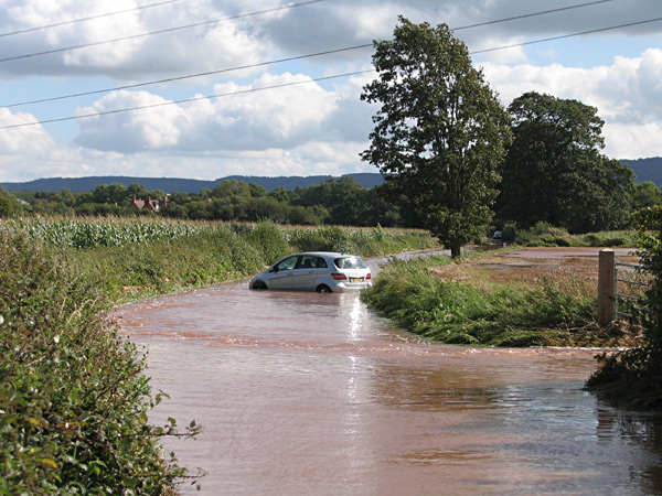
Sometimes it rains. And then sometimes it pours and floods. The photo at left was taken just south of Hornshay Farm looking towards the railway. This is some general information for those new to the area about which roads flood.
The short answer is that occasionally they all do. Working outwards from Nynehead, the map at the bottom shows with a red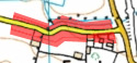 outline which sections of road are particularly liable to flood. Sections of road further out also flood but these are not shown. The red is not intended to delineate the lateral extent of flooding but only the approximate secion of road affected. Click the map below to enlarge.
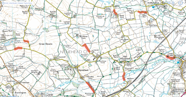
It is not possible to state with certainty which road will flood first. Much depends on local conditions; which drain is blocked, what ditches have not been kept clear etc. But generally speaking, the last road to flood is that going west from Nynehead towards Chipley and Langford Budville. But very occasionally, Nynehead is marooned.